Seoul has a granite national park on the number 4 line. That sentence still sounds wrong to people the first time they hear it, and it’s the most underrated thing about the city.
Which means going outside here isn’t one decision, it’s a dial. You can drop three metres below the pavement and walk beside water for twenty minutes. You can give an afternoon to a park big enough to get lost in. Or you can spend six hours on a mountain and come down with your legs shaking. All three start at a subway station.
This is the three settings on that dial, in order of how much you have to give them.
Twenty minutes — Cheonggyecheon
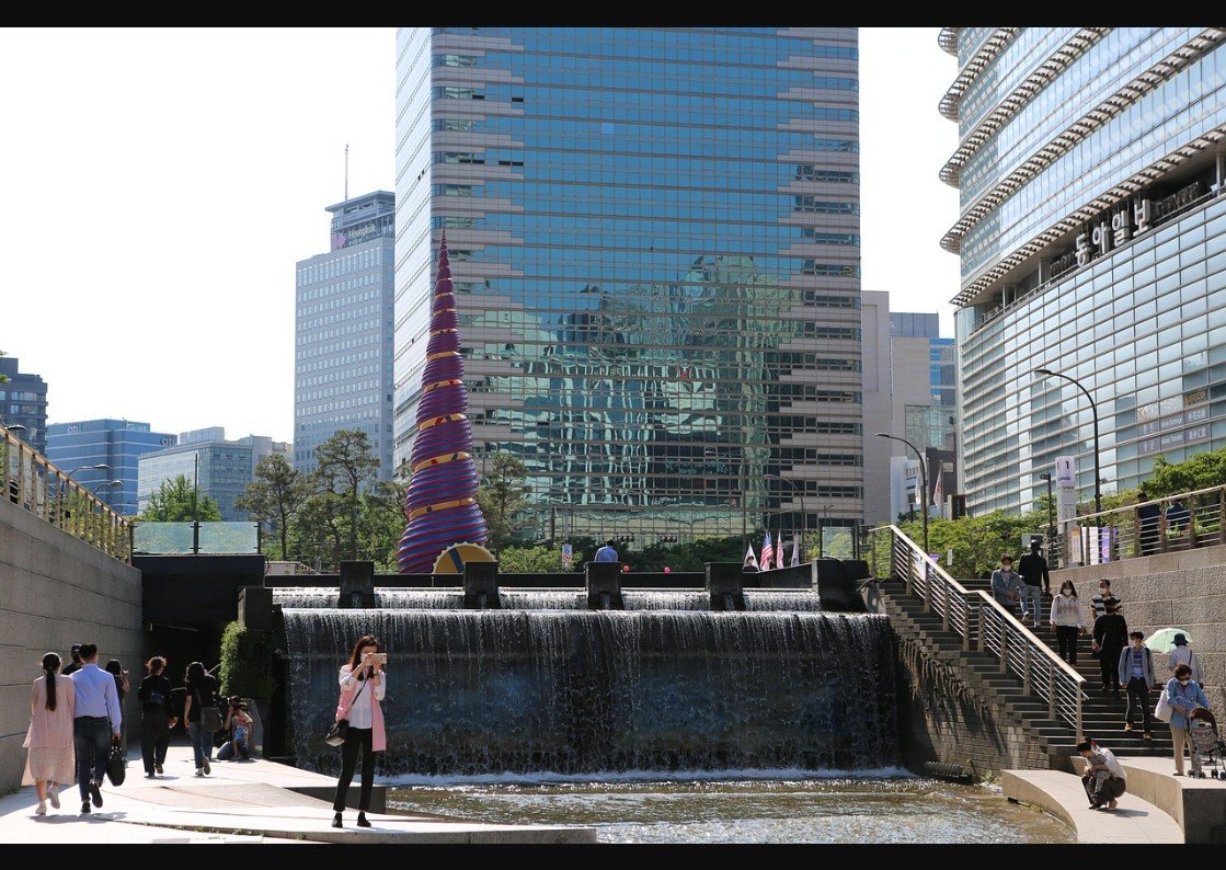
People describe Cheonggyecheon as “a stream in the middle of the city,” which undersells and oversells it at once. It’s a narrow, mostly concrete channel running below street level through downtown, and for the first ten minutes most visitors look faintly puzzled about why it’s on so many lists. Then they keep walking and it clicks.
Here’s what the photographs don’t carry. You go down a set of stairs from the pavement near Gwanghwamun — by the big coloured snail-shell sculpture everyone photographs without knowing what it is — and the traffic noise just stops. You’re three metres below street level, walking next to moving water, and the city above might as well be a different building. That drop in noise is the whole trick of the place.
A bit of context makes the walk better: this was an elevated highway. A rattling, shadow-casting overpass running straight along the old stream bed after it had been paved over decades earlier. In 2005 the city tore it down and daylighted the stream underneath. It reads as a tidy urban-renewal story now; it was genuinely contentious at the time, and shop owners were furious about the construction. It’s one of the few redevelopment projects here that improved daily life rather than just looking good in renderings.
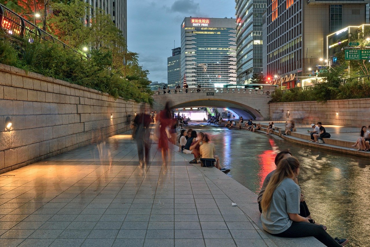
The walkable stretch runs close to eleven kilometres if you follow it out to where it meets the Jungnangcheon past Dongdaemun. Nobody needs to do that. Most people cover the first two or three kilometres, from Cheonggye Plaza past Gwangtonggyo and the old stone bridges, then climb back up wherever they get tired or hungry. You’ll pass office workers eating gimbap on the steps at lunchtime, older men doing very serious speed-walking, and stepping stones that children insist on using despite a perfectly good path two metres away.
Timing. Around seven or eight in the morning it’s almost meditative — low light, a little mist off the water in the cooler months, hardly anyone about. At lunch it’s office workers on their break, which has its own charm: a man in a suit staring at his phone with his shoes off and his feet in the water. Evenings are busiest and louder, but the lighting along the walls turns the channel photogenic in a way it simply isn’t at noon. If you only get one, take the evening and accept the company.
If your trip lands in November, the Seoul Lantern Festival runs along this stretch and is worth rearranging a day for. Hundreds of lit sculptures float on the water and line the walkway. Quality varies piece to piece; the whole channel glowing at once does not. Weekends are shoulder to shoulder, so go on a weeknight if you can.
Free, open around the clock, no gate. There are carp in it, enough that children point them out to you unprompted. In summer the lower sections get humid and buggy toward evening. And in heavy rain the walkway closes — it floods fast, and there are sirens and warning lights built into the walls for exactly that, which is unsettling the first time you notice one. After hard rain, check before you make the trip.
It won’t be the highlight of anyone’s photographs, and I wouldn’t build a day around it. As a way to cross downtown on foot, cool off, or get between two neighborhoods without traffic, I use it more than almost anything else in this article. It works better as somewhere you pass through than somewhere you go.
An afternoon — Seoul Forest
Everyone ends up in Seongsu-dong for the cafes eventually. Right next to all that, across the elevated road, is a park most visitors walk past without registering how big it is. Seoul Forest is over 1.1 million square metres, split into five quite different zones, and you could give it a whole afternoon and still miss half.
It was a golf course before this, and briefly a military riding ground before that, back when the area wasn’t considered central. The city made it a park in 2005, young by Korean standards, and you can tell — the layout feels planned on a drawing board rather than grown. Not a complaint; it just explains why everything is so clearly zoned. Culture and arts near the entrance, then the eco forest, the deer paddock, the insect garden, and the wetland field running along the Jungnangcheon toward the Han.
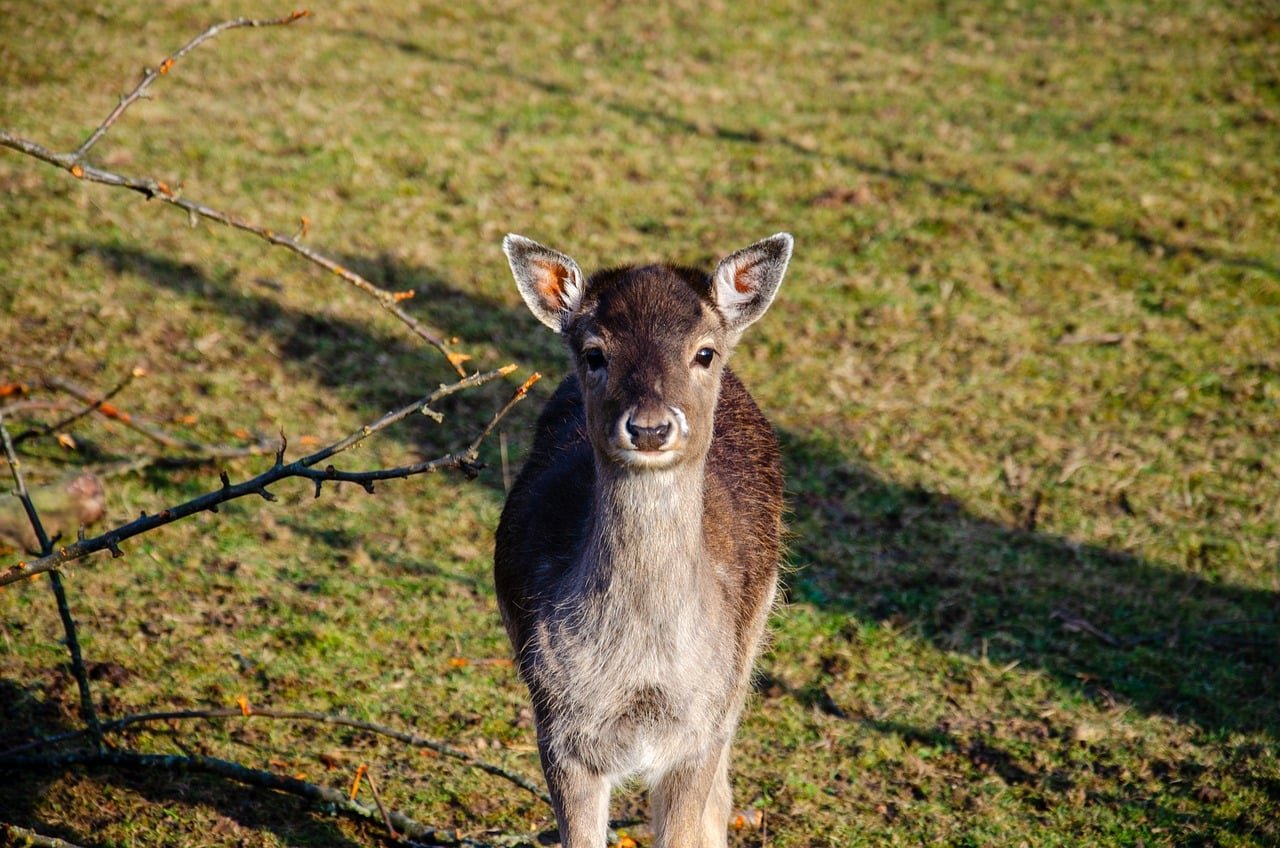
The deer are the main event whether you planned for them or not. A fenced enclosure with dozens of them, mostly sika, a few spotted ones so symmetrically marked they look fake up close. You can’t feed them — the rules were looser years ago and have tightened, with signs everywhere. Children press their faces to the fence anyway. So do plenty of adults.
Late afternoon on a weekday and you might have the enclosure to yourself for a few minutes. Weekend mornings turn it into a small crowd, not unbearable, just enough that you wait for a gap to get a clean photo. No ticket, no booth, nothing gated beyond the fence itself, which surprises visitors who assume a deer park in a major city must be a paid attraction.
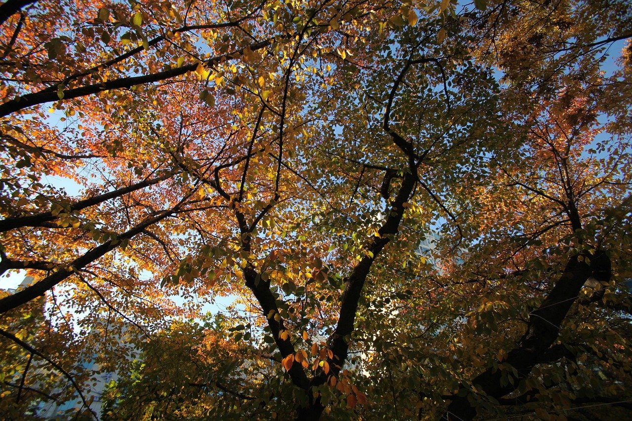
The part people skip is the eco forest, and they shouldn’t. Past the paddock the crowd thins fast, and there are wide fields of silver grass that turn copper-gold in autumn. It feels less designed than the manicured areas near the entrance — an actual field someone forgot to landscape into submission. Late October into early November is the peak, and it lines up with the maples turning elsewhere in the park. On a clear cold morning the light through the grass is one of the better free views in the city. Spring is a different mood: cherry blossoms along the entrance paths, nowhere near as packed as Yeouido, which I count in its favour.
Ttukseom Station, Line 2, Exit 8 puts you at the main gate; Seoul Forest Station on the Bundang line is closer to the wetland and river side. Flat and easy either way. There’s a bike rental near the entrance if you’d rather cover more ground than your legs want to, and bring a mat if you’re picnicking — there’s grass everywhere and nothing provided, and the shaded spots go by early afternoon on a nice Saturday.
One thing catches people out: this is not a see-it-all-in-an-hour park. If you’re also fitting in Seongsu’s cafes and the Han River path the same day, budget more time than feels necessary. I’ve had visiting friends underestimate the walk from the deer to the riverside and rush the best part.
A whole day — Bukhansan
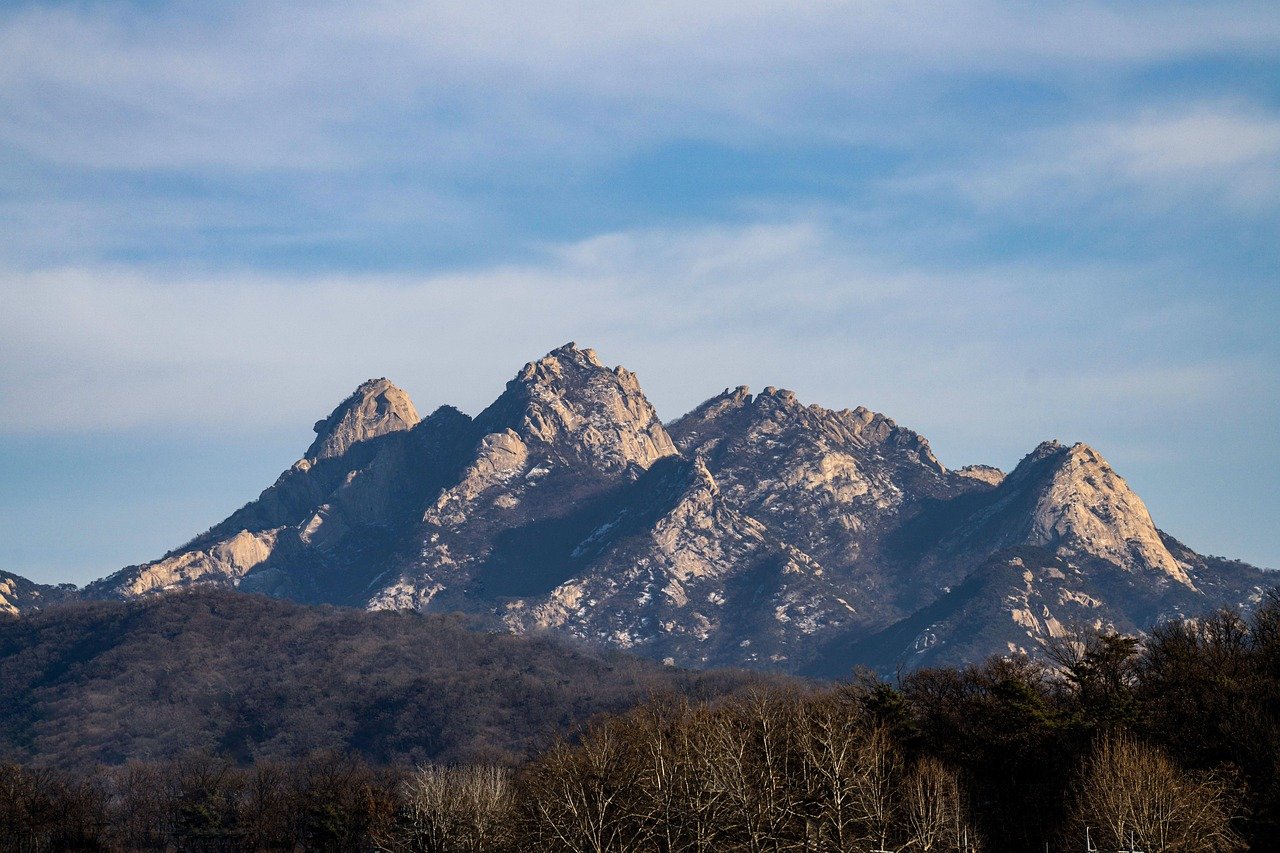
I used to think a national park inside a capital was a strange idea. Then I stood at the Bukhansanseong entrance on a Saturday morning surrounded by a few hundred people in full mountaineering kit, heading up a trail that tops out under 850 metres, and I understood. Koreans do not do casual hikes. They do expeditions, even when the mountain is a subway ride away.
Bukhansan sits on the northern edge of the city, and its granite peaks are the ones you see behind apartment blocks from half of Seoul. The high point, Baegundae, is 836 metres — modest until you’re gripping a steel rope on bare rock with a queue behind you. It isn’t technical. It isn’t a stroll either, and the last stretch surprises people who assumed a national park near a subway meant a flat path.
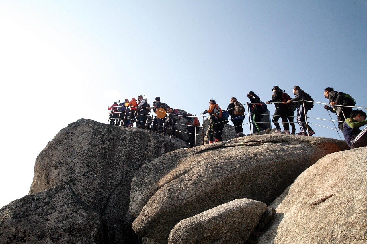
Most people start from the Bukhansanseong entrance, the most direct line to Baegundae — roughly two and a half to three hours up at average fitness, with photo stops, which you will take. On the way you pass sections of the old fortress wall, built in the early 1700s as a last defence for the Joseon court if the city fell. Parts rebuilt, parts original, and walking beside it with the ridge dropping away is a better stretch than the summit scramble, in my opinion.
For something quieter, the Doseonsa temple route from the east is less crowded and passes a working Buddhist temple partway up — worth ten slow minutes even if you’re not stopping. It joins the main summit push eventually, so you don’t fully escape the crowds, but the first hour is calmer.
On crowds: go early. Not early-for-a-tourist early — actually early. By 9am on a clear autumn weekend the trailhead is a slow-moving line, and the narrow rock sections near the top back up for twenty minutes at a time. Weekday mornings are a different mountain: half the people, and you can hear wind instead of someone’s hiking pole clicking six inches behind you.
Seasons matter here more than anywhere else in this article. Autumn, late October into early November, is when the maples turn and the ridge goes orange — also peak crowds, so it’s a trade. Spring brings azaleas on the lower trails and milder temperatures. Summer is humid and buggy with hazy visibility from the top; skip it unless it’s your only window. Winter is genuinely beautiful, sharp cold days with visibility across the whole city, but the rock near the summit ices over and you’ll want traction spikes — aisen, sold cheaply at any outdoor shop near the entrance. Trainers on icy granite is how people slide down on their backsides, and I’ve watched it happen more than once.
You don’t need the full outfit, but wear hiking shoes with grip rather than fashion trainers. Carry more water than feels necessary; there’s a snack stand near the entrance and almost nothing on the trail. Toilets are scattered rather than frequent. Take your rubbish back down — there are essentially no bins past the entrance, which is part of why the trail stays as clean as it does.
And don’t skip the drink at the bottom. Locals call it hasanju, the drink after coming down the mountain, and the restaurants clustered at the Bukhansanseong entrance exist entirely for it — pajeon and a bottle of makgeolli at a plastic table, still in your hiking clothes, boots caked in dust. Do this. It’s cheap, it’s satisfying in a way that’s hard to explain until your legs are actually tired, and it’s a better read on Korean hiking culture than the summit photo everyone takes.
Which one, and when
- You have twenty minutes and you’re already downtown — Cheonggyecheon, evening.
- You have an afternoon and you want grass — Seoul Forest, late afternoon on a weekday, and walk past the deer into the eco forest.
- You have a whole day and don’t mind aching — Bukhansan, starting before eight, with the pancake and makgeolli booked into the plan.
- It’s raining hard — none of the three. Cheonggyecheon closes, the mountain turns dangerous, and the park is just wet. Go indoors.
The dial is the point. Most cities make you choose between a park and a proper mountain by committing half a day to travel. Here the difference between the three is the number on the subway line.
Read next
- Four Seoul neighborhoods — Seongsu is ten minutes from Seoul Forest.
- T-money card — how you reach all three.
- Convenience store food — what to put in the bag before a hike.